 THE TREACHEROUS SANTUBONG – 3/June/2007
____________________________________
The Gunung Santubong is located at the center of the Damai peninsula north of Kuching (45 min driving distance) on the South China Sea coastline. There are two access to the trail: the first, a bit difficult to spot but somewhat shorter, is on the main Damai road exit at about 1 Km past the junction to the Santubong village; the second further down the road (close to the Holiday Inn Damai Beach resort) is well signalled through a gated hallway.
The trail starts through a medium slope through heavy rooted jungle terrain and about mid way turns into a series of almost vertical walls (8-10 meters high) well equipped with fixed nylon ropes and wooden ladders. There are 6 check-points along the trail. Bring trekking poles (very handy on the way back), a pair of sturdy gloves and a supply of black garbage bags. If you are in the mood, you can help to carry down the piles of scattered garbage that unfortunately uneducated masses take up during the popular weekend trips.
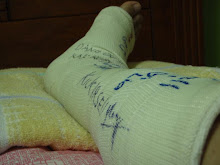
Our journey starts at 7.30am from the Green Paradise Café (the longer route). This route actually goes thru the jungle passing thru the water fall, beautiful view though but lesson learnt here is that if you are equipped for the summit better take the shorter route. The route thru the jungle took us about 2 ½ hours to the junction, from the junction it takes another 2 ½ hours to the summit. The beginning of the journey was quite tolerable but the more deeper and higher it goes the terrain was treacherous. Going to the summit really requires one to be strong, mentally and physically. When I looked back at my journey to Mount Kinabalu years back, seems like it was much easier then Mount Santubong. Congratulations to those who had reached the summit of Mount Santubong, I salute you for your determination and stamina to hike to the summit.
The trail starts through a medium slope through heavy rooted jungle terrain and about mid way turns into a series of almost vertical walls (8-10 meters high) well equipped with fixed nylon ropes and wooden ladders. There are 6 check-points along the trail. Bring trekking poles (very handy on the way back), a pair of sturdy gloves and a supply of black garbage bags. If you are in the mood, you can help to carry down the piles of scattered garbage that unfortunately uneducated masses take up during the popular weekend trips.
Our journey starts at 7.30am from the Green Paradise Café (the longer route). This route actually goes thru the jungle passing thru the water fall, beautiful view though but lesson learnt here is that if you are equipped for the summit better take the shorter route. The route thru the jungle took us about 2 ½ hours to the junction, from the junction it takes another 2 ½ hours to the summit. The beginning of the journey was quite tolerable but the more deeper and higher it goes the terrain was treacherous. Going to the summit really requires one to be strong, mentally and physically. When I looked back at my journey to Mount Kinabalu years back, seems like it was much easier then Mount Santubong. Congratulations to those who had reached the summit of Mount Santubong, I salute you for your determination and stamina to hike to the summit.
Another lesson learnt, bring along plenty of bottled water and energy food to keep you going for miles and miles up.
Leave nothing but footprints and sweet memories to cherish.
(Elevation (feet) : 2658ft Elevation (meters) : 810m Latitude : 1.7333 Longitude : 110.333)


No comments:
Post a Comment